Saturday, October 24, 2015

Sassafras Creek - October 2015


Hey hey its time for another hardcore edition of goin' feral, yeah once again I spent my Saturday morning drinking coffee over breakfast and reading the paper, so by the time I actually headed off  for the walk it was already after twelve. I'm a one man recession buster for the cafes in my area, my Sunday morning haunt actually has the coffee on the table before we even make it up to the counter to order, that's service for you, thanks Chelsea! So anyway seeing as I only had half a day I figured that I'd better not travel to far afield, after consulting my library of guide books I decided on an old favourite up at Kallista in the Dandenong Ranges, the walk I planned had the added advantage in my eyes of being relatively short, perfect for my current unfit state!
Climbing up the Old Sherbrooke Road easement out of Kallista.

Parking at Kallista at my usual start time of around 2pm I immediately pulled on the boots and headed straight out of town, the walk climbs up to the north east along an old road easement, Old Sherbrook Road before meeting the current Sherbrook Road near the entrance of George Tindale Memorial Garden. One of the features of this walk is the fine public and private gardens that the route passes. With the weather a bit overcast I decided to head into the gardens to get a bit of colour in my photos as it didn't look like I was going to get much blue sky. The George Tindale Memorial Gardens really demand more than the fifteen minutes or so I spent wandering around, they would be a great place for a picnic on a hot day.
George Tindale Memorial Gardens.

The Chilean Monkey Tree in the George Tindale Memorial Gardens.

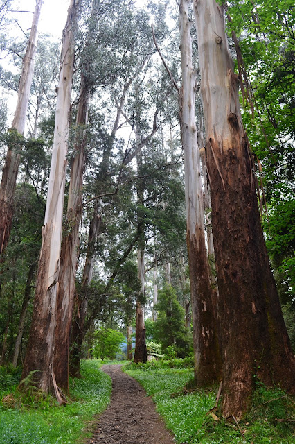
Leaving the George Tindale Gardens I now headed along the foot path that runs beside Sherbrooke Road, the walking along here is better than may be expected with towering Mountain Ash on the left side of the road for a lot of journey and fine exotic gardens on the right side of the road. Around twenty minutes along Sherbrooke Road I headed to the right down the gravel Nobles Lane, initially passing some more grand homes with their immaculate gardens before eventually the lane turned into an easement as it plunged down into the valley of Sassafras Creek. Near the bottom I rejoined Nobles Lane and passed through the fence on my left into the second public gardens of the day, the Alfred Nicholas Gardens. Like the George Tindale Gardens, the Alfred Nicholas Gardens were beautifully maintained and provided quite a contrast to the towering Mountain Ash and messy temperate forest surrounding them. 
Walking along Sherbrooke Road past the private gardens.


One of the stunning homes off Nobles Lane.
The Alfred Nicholas Garden.

Another couple of minutes walk down Nobles Lane and I arrived at Sassafras Creek and met up with the old Dandenong Ranges Walking Track. This was my favourite part of todays stroll, the damp ferny DRWT follows Sassafras Creek downstream, benched into the hillside a few metres above the creek, the native forest vegetation along here is stunning, a hot bushfire hasn't come through here for a long time and the ferns and trees are magnificent, it was quite a contrast to the manicured exotic gardens that I'd passed earlier. All to soon I arrived at the Beagleys Bridge Picnic Ground and my creek side walking was finished for today, after trying to get a half decent shot of Sassafras Creek I headed off towards Kallista.
Back in the native bush along Sassafras Creek.
Mountain Ash.
Part of the long(ish) distance Dandenong Ranges Walking Track.
Sassafras Creek near Beagleys Bridge.

On leaving the picnic ground I also left the long distance DRWT and headed along bitumen roads back up towards town, firstly the quiet Sassafras Road before lastly the main Kallista to Monbulk Road. Climbing up into Kallista I passed the old tea rooms that Sam and I used to frequent when we were living in Belgrave, these tea rooms used to be the spot to bring visitors from overseas to see some native birds however it looks like they have removed the feeding stations so I'm not sure what the go is now. I headed a little further up into town to Kallista Deli for a coffee and some cake and can thoroughly recommend it if your looking for something to eat in the area. After topping up my caffeine levels I crossed the road and arrived back at the ute, finishing a very nice walk.
The Kallista Tea Rooms used to be the spot to go to see native birds up close, although I'm not so sure now.
When in Kallista the feral walker re caffeinates at the Kallista Deli.

The Dirt.
Like I mentioned at the start  I've done this walk before so I knew what I was involved, its a great little walk though with something for everyone I reckon, great exotic gardens, stunning native bush, a nice little creek, some fine old houses to sticky beak at, at finally a great cafe to finish your walk at...what more could you want? The route basically heads in a north westerly loop out of Kallista in the Dandenong Ranges, dropping in and out of the Dandenong Ranges National Park along the way. I walked about 7.75 kilometres and climbed 189 metres on this stroll. The walk was written up years ago by Tyrone Thomas in his book '40 Bushland & Park Walks in Metropolitan Melbourne'. The book is long ago out of print and I think Tyrone is now retired, if anyone wants more detailed notes get in contact with me and I'll see what I can do.


Friday, October 16, 2015

Capel Sound - October 2015

Milford Sound, Doubtful Sound, Last Hope Sound and now Capel Sound, now I've got a fair idea what you're thinking, 'where has this tosser been now'. Well the truth is it's not really that exotic, Capel Sound is actually Rosebud West, yes Victoria's own version of 'god's waiting room' where all the cars have hats on the parcel racks and carpet on the dash. Even the locals must think Capel Sound rolls off the tongue a little better than Rosebud West as there is a grass roots campaign running to actually officially change the name. Now I'd normally regale you with a few facts about Capel Sound about now but there is not a lot of information floating around the interweb about Capel Sound, the best I can come up with is it is thought to be named after a Commander-in-Chief of the Royal Navy's Far East squadron, a Mr Thomas Bladen Capel way back in 1836. Not having a lot of joy finding information about Capel Sound I figured that I could just crap on about the difference between a 'sound' and a 'fiord' for a bit, but on consulting Wikipedia ( hey its good enough for our environment minister!), and reading the first sentence my eyes immediately glazed over (come to think of it the same thing happens when I listen to our aforementioned environment minister, Mr Hunt). This is what Wikipedia says about a 'sound'...."A sound is a large sea or ocean inlet larger than a bay, deeper than a bight, and wider than a fiord; or a narrow sea or ocean channel between two bodies of land", is it just my year ten public school educated brain or is that a bit vague? Anyway now everyone is clear on why Capel Sound is a 'sound' I suppose I'd better talk about the walk.
Rosebud Pier.
First up I've got to say this isn't a hard walk that's going to throw navigational challengers at you, I basically walked from Rosebud Pier along the beach down to Rye Pier, before heading inland twenty metres or so and walking back to Rosebud Pier along the multi use path that runs along the foreshore. After parking the ute I headed out onto the pier to see if I could get a good shot as a 'start' photo, you'll have to judge for yourselves but I was a little under-whelmed with my work, Arthurs Seat did look okay and the turquoise water and white sand of Port Phillip Bay looked pretty good in the midday sun, but I struggled to do much with it.
Looking up Port Phillip Bay towards Arthurs Seat.

Returning to the sand I took off my boots, turned right (west), and kept going for around 9 kilometres. Being the day of the AFL Grandfinal the beaches today weren't overly crowded, even though with a temperature in the high twenties it was almost perfect beach weather. I'm not totally disorganized and I'd timed this walk with a lowish tide so the sand walking was pretty easy, I spent some time just above the waterline but where I could I splashed my way along the extensive sand banks that the low tide had exposed. Walking this coastline has a bit of another era feeling about it, with small fishing dingy's bobbing in the shallow water in spots, and a foreshore lined with boathouses and pine trees, it feels like a 1960's seaside resort, or maybe its just me?

One thing that doesn't make me think of the 1960's is the kite surfers, with a pretty decent north westerly blowing  the kite surfers were out in large numbers, these guys and girls are amazing and I spent a lot of my time ambling along whilst checking out their gravity defying manoeuvres. Crossing over Chinamans Creek I was pleased to see that someone had spent a lot of time re-vegetating the creek and its surroundings area, a credit to the (what I presume are) volunteers. I now walked along a relatively quiet stretch off the bay being halfway between Rosebud and Rye, at one stage walking through a large group of Black Swans floating in the water just off shore, I'm not sure why they congregate in that particular place but congregate they did.
These kite surfers are amazing to watch.
Chinamans Creek.
I'm not sure what the 'go' was with this spot but the Black Swans seemed to like it.
By now, after plugging away through the shallows for a couple of hours, my half way point had come into view. It was with a little relief to my tired feet that I finally left the sand and water and climbed onto dry land and pulled on my boots. After checking out Rye Pier I headed onto the foreshore and turned left (east) and started my return journey along the foreshore reserve. Now I didn't have high hopes for this section of today's stroll as the track is wedged into a small sliver of land between the beach and the Nepean Highway, but maybe as I was fearing the worst, or maybe because my feet were happy to be in boots and off the sand but the walk back wasn't too bad really. I'd better add a word of warning here though in case anyone wants to follow my steps, this section would be misery in the summer months as the annual migration of holiday makers in their caravans and tents occurs, the foreshore becomes our equivalent of a shanty town with all the punters jammed in cheek by jowl, all anxious to feel the serenity, I'd give it a miss.
I was enjoying walking in bare feet after weeks of walking in my boots, well at least for the first hour or so anyway.
My halfway point is just in view.
The Norfolk Island Pines on the Rye foreshore.
Rye Pier.
Arthurs Seat from the end of the Rye Pier, time to start heading back.
Anyway by now I was getting a little tired so I was quite happy when I notice a sign telling me that it was only a couple of kilometres back to Rosebud. The forecast for today had been for mostly sunny conditions so I'd driven down with anticipation of a bit of polariser abuse, the reality today though was that I got basically grey and overcast conditions all afternoon. Just before getting back to the ute I decided to head back down to the beach and see if I could get anything out of the sunset, once again you'll have to be the judge but once again I was under-whelmed with my effort. All that was left now was to amble back the last few metres, chuck everything into the ute and head home.
My return route was along the bay trail that runs along the foreshore.
I've made it back to the swans.
The Dirt.
I'm not sure if it comes across in my writing but I actually didn't mind this walk, yeah it would have been better with blue skies, but what do you do? It was nice to walk along in bare feet splashing through the shallow water after spending three weeks in boots in the UK, and while its definitely not a wilderness area its great to see the results of the people who must put in a lot of volunteer hours caring for the beach and its foreshore. I walked almost 19 kilometres on this stroll and climbed just over 60 metres (it must have been bending over to take photo's as you wouldn't get a flatter walk). The section of the walk from Chinamans Creek to Rye has been written up by Ken Martin in the book 'Walks of the Mornington Peninsula', from what I can tell he doesn't have a web site so no link.

Looking down Port Phillip Bay, or across Capel Sound, towards Port Phillip Heads.

My last forlorn attempt to capture an interesting image today.

Saturday, October 10, 2015

Glasgow, Scotland - September 2015

I've been a bit slack with my blogging output since we returned from the UK, most of my time has been taken up with work (yeah, its hard to believe if you look at my blog but I actually hold down a real job and don't just spend all my time swanning around on different adventures!). The other thing that's taking up my time is writing up my crazy guy journal of the West Highland Way, I love the journals because they allow me to write up multi day walks in magazine style format but they take a bit of time to write up. I've considered writing up multi day adventures one day at a time on the blog, but the thought of the posts basically appearing in reverse chronological order does my, admittedly somewhat anal, brain in. So anyway for the time being I'll keep writing up my multi day trips on my journal and posting a synopsis with a link on the blog. So onto this post, with the annual migration of my bogan brothers and sisters to Mt Panarama in Bathurst on, I've found myself a bit of time to sit on the couch and while I watch the racing and type up a post. After a long deliberation I decided to write about Glasgow (actually they were the photos that I'd already uploaded so it saved me getting up off the couch). Glasgow may not seen like the most obvious place to do a post on, but then again I don't like being too predictable.
The advantage of the train over the plane is that you arrive in the middle of the city.
Our hotel in Glasgow.
We arrived in Glasgow in mid afternoon after a Virgin Train journey up from London, I would of liked to do a post about the fast train but couldn't bring myself to actually take any photos. I think it was about 4.5 hours from central London to central Glasgow, so by the time I factored in getting to and from airports it was probably as quick as flying, and we saw a whole lot more of the country, including passing through the Lakes District in northern England. Lugging our bags out of Glasgow Central Station we grabbed a cab for the very quick trip to our accommodation, the Glasgow Hilton. Situated in the western end of the Glasgow CBD the hotel overlooked a large freeway and was fairly non de script from the outside, from the inside it was clean and modern, pretty typical for a Hilton hotel.

With a population of slightly less than 600,000 people, Glasgow has a reputation for being a bit grey, rough and gritty, well from what I'd heard anyway. Our first afternoon in town was spent taking a quick walk around the CBD getting a bit of an idea of the lay of the land, admiring some of the beautiful Victorian buildings before heading out to a great restaurant for dinner. When I visit new cities I tend to explore a bit further away from my home base with each new excursion, and Glasgow would be no exception.
Heading into Merchant City.
The many hands make light work method, I'm not sure that the CFMEU would approve.
On our second day we started off at the Buchanan Street Mall, checking out a few of the shops as we meandered our way down towards Merchant City and our first stop the Gallery of Modern Art. The gallery is housed in a impressive old building and features a fairly wide selection of displays, from old masters, to contemporary art, there is even an aboriginal dot painting on display. After spending an hour or so taking in everything at the gallery we headed up to George Square, the square is surrounded by fine old Victorian era buildings, with the impressive City Chambers which were built in 1880's at its eastern end. One of the City Chambers claims to fame is that has been used as a movie location to represent the Kremlin or the Vatican, having never actually been to the Kremlin or the Vatican I can't vouch for the likeness, but it's an interesting bit of trivia.
A dot painting in the Gallery of Modern Art, Glasgow.
The City Chambers.
The Gallery of Modern Art.

The Gallery of Modern Art, check out the sculpture.
George Square.
We now wandered around Merchant City, checking out all the nooks and crannies, the old buildings and trendy cafes being a highlight of this vibrant neighbourhood. Slowly we made our way to High Street, a fairly major road by the look of it, which we followed up to the Cathedral. The Cathedral and its neighbour The Necropolis are situated on top of a bit of a hill, so apart from the historic interest they provided the best overall view of Glasgow that we would get. The Cathedral dates from the 15th century and its dark gothic presence stands out even today. The Necropolis is situated on a grassy hill behind the Cathedral, apart from the views of Glasgow the Necropolis's old graves and headstones and Victorian tombs were interesting to stroll through and check out.
Merchant City.
Public electric car charging points, coming to Australia next century.
Glasgow hosted the Commonwealth Games in 2014.
After checking out the Necropolis we headed back towards the CBD, stopping on the way at one of the cafes in Merchant Town for some late lunch. Glasgow hosted the Commonwealth Games last year and it appears that the city spent a bit of money on street art, there are some great street murals spread out around Glasgow on various walls. After a coffee and a bite to eat we headed to the Argyll Arcade where Sam discovered the biggest toy shop that I've ever seen where we were able to indulge our inner child, they didn't have toys like this when I was a kid. From the toy shop we thought that we'd better go down and check out the River Clyde where we watched the trains coming and going over the bridge into Glasgow Central for awhile. We were now getting a bit tired so we headed back to our hotel via a few bookshops. That night we went out to a restaurant called Viva Brazil, the go in this place was that they issue you with a card with around twenty different cuts of meat on it, the waiters then bring the cooked cuts of meat to the table one at a time and stamp your card as you slowly make your way through all the different cuts. Now I'm pretty good on the tooth and I don't mind my meat, but I was defeated today, there was no way I could get through twenty different cuts.
The Gothic Glasgow Cathedral.
St Mungo's Museum of Religious Life & Art.
The Necropolis, with Glasgow in the back ground.

There is plenty of good street art in Glasgow.
Just what every child needs, a life sized stuffed giraffe.
The River Clyde.
Now we have to jump into the time machine and go forward a couple of weeks, when we returned to Glasgow after walking the West Highland Way. Once again we stayed in the Hilton at the western end of the CBD, on this visit though we wanted to check out the West End of Glasgow. In particular we wanted to have a look at Kelvingrove Art Gallery & Museum, this was the spot that I'd decided to start my West Highland Way walk from. This massive museum and gallery was the best attraction that I visited in Glasgow, the museum holds hundreds of exhibits ranging from natural history and archaeology to social issues from around the world. The museum even had a section on indigenous land rights issues from around the would, with a display of Australia's aboriginal tent embassy in Canberra, as well as some indigenous art on display. It wasn't all heavy going though with Art Deco displays and plenty of natural history for the kids (and me). Returning to our hotel in the late afternoon we had a quiet night in, having a couple of quiet drinks in the hotel bar while I made use of their free wifi.
Kelvingrove Art Gallery & Museum, this is the spot I actually started my West Highland Way walk from.
The Kelvingrove Museum had a large area dedicated to social issues from around the world.
And from closer to home.
With some modern art.
Along with some older stuff, this one is called 'the ghosts of Glencoe' if I remember right, the artist is thought to have chosen this spot to paint due to its importance in Scottish history as it was the sight of the 1692 massacre, of which I might touch on when I post about our West Highland Way walk.
Elvis even got a run.
The Dirt.
Far from being grey and drab I found Glasgow cosmopolitan and vibrant, the cafes and restaurants were many and varied and while the sky may be a bit drab the people are bright and sunny. We were lucky in that both our visits were in fine weather, the city is compact enough that if you're reasonably active you can visit most of the attractions fairly easy on foot, the other thing to note is that Glasgow is fairly flat so that also helps if exploring on foot. If you are checking the sights out and the weather does deteriorate then the taxis in Glasgow are reasonably priced.The Necropolis provided the best view over town with the Cathedral in the foreground to add interest.The Gallery of Modern Art was good but Kelvingrove Art Gallery & Museum was better in my opinion, and while you're out at Kelvingrove you can check out Kelvingrove Park on the River Kelvin. a very pleasant spot for a walk and a likely location to spot a squirrel. We stayed at the Glasgow Hilton which was a nice hotel in the typical Hilton tradition, one thing to note is the lower rooms are a bit dark and gloomy inside, where as the higher rooms are a lot lighter band airier, so ask for a room up high. We had free wifi and brekky included. We got to and from Glasgow on the train from London and that was a great experience in itself, it would be awesome if we had some of these high speed trains in Australia.
Look hard and you'll see a squirrel, Kelvingrove Park
Sunset over the west end of Glasgow from our room.

Pelion Hut to Mt Ossa return, Overland Track - April 2010

Mt Oakleigh from the Pelion Hut heli pad. I think the mountain just visible in the mist in the distance is Cradle Mountain... ... the flat t...