 |
| This'll be another post with lots of photos of trees. |
I suffered a little from a bit of apathy this Saturday, work had been busy and I'd been dealing with a medical issue in the family so by the time Saturday rolled around I was thinking a day sitting on my ever expanding arse watching the cricket might have been in order. After mucking around for awhile eventually I decided to make the fairly short trip up to Gembrook and do one of Mr Chapman's walks, the Tree Fern Walk. Consulting Mr Chapman's walks up date page I noticed that he was warning that the start of the track was a little hard to find, but apart from that everything should be pretty straight forward. No worries then....
 |
| Mr Chapmans update page suggested that the start of the track is hard to find, just look for this boardwalk leading away from the picnic area and you're on the way. |
Light showers were predicted in Melbourne this morning with the temperature meant to get into the mid twenties so I wasn't surprised to pull into the almost empty car park at the Mortimer Picnic Ground under grey skies. Pulling on my boots I set off to look for the supposedly elusive start to the walk, expecting to have to do a bit of detective work to find the track I was somewhat surprised to see that the start was obvious, alright it wasn't sign posted but it was exactly were the notes said it was. I was heading along the left hand fork of a short nature trail this morning as I made my way to Steege Road, the nature trail was an interesting start to the day in that it passed through a variety of eco-systems that were explained by a series of information boards.
 |
The initial section of today's walk follows a nature walk as it heads up Diamond Creek, crossing the creek a couple of times on duck boards.
 |
| Stringybark Forest. |
|
Reaching Steege Road I dropped down and crossed over William Wallace Creek before starting to climb. I was meant to pick up Parker Link Track around now and sure enough, a minute or so after crossing the creek I arrived at what use to be Parker Link Track. Unfortunately this track has now almost totally been reclaimed by nature, but being the Feral walker I decided to see if I could follow it anyway. Initially I stuck to and old benched track but before long I realized that I was heading too far west and my route was meant to start heading north and start climbing. Not being one to give up I headed across country through the light forest hoping to pick up a bit of a walking pad, now there were lots of pads but to my eyes they were all animal pads as they all faded in and out. According to my map and GPS I should of been right on track but there was nothing to be found on the ground, after casting around a little as I climbed eventually I decided that the pad had more or less gone so I decided to cut back across and re-join Steege Road, on the way checking out a huge lichen covered granite boulder.
 |
Crossing William Wallace Creek I was looking for the start of Parker Link Track.
 |
The start of what use to be Parker Link Track.
 |
Eventually I got sick of my off track ramble so I headed across to meet up with Steege Road again, passing this huge granite boulder in the process.
 |
Back on Steege Road.
 |
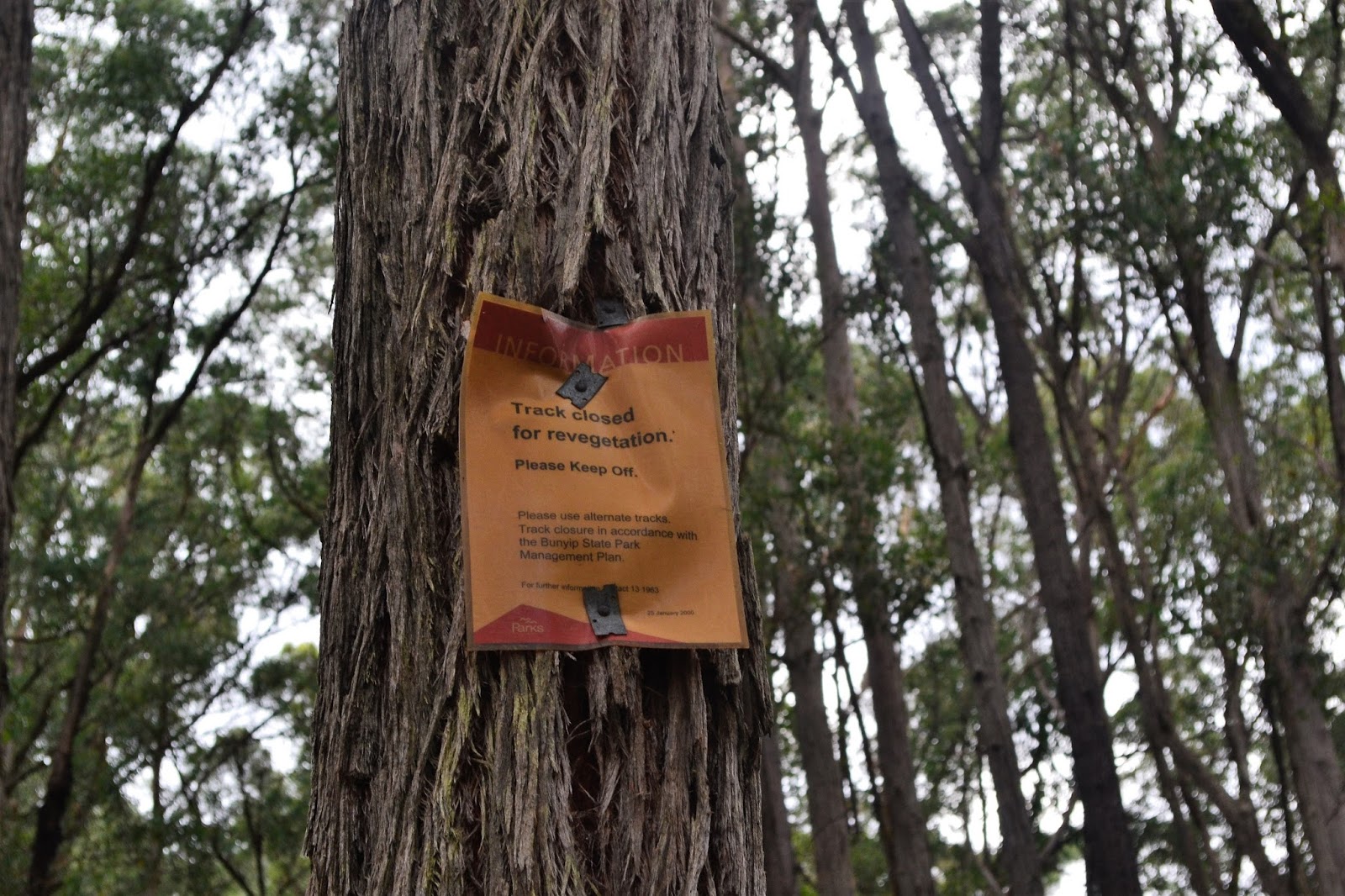
| This notice was about three metres off the ground in a tree on Steege Road, I've got no idea which track they are referring to. |
|
|
|
|
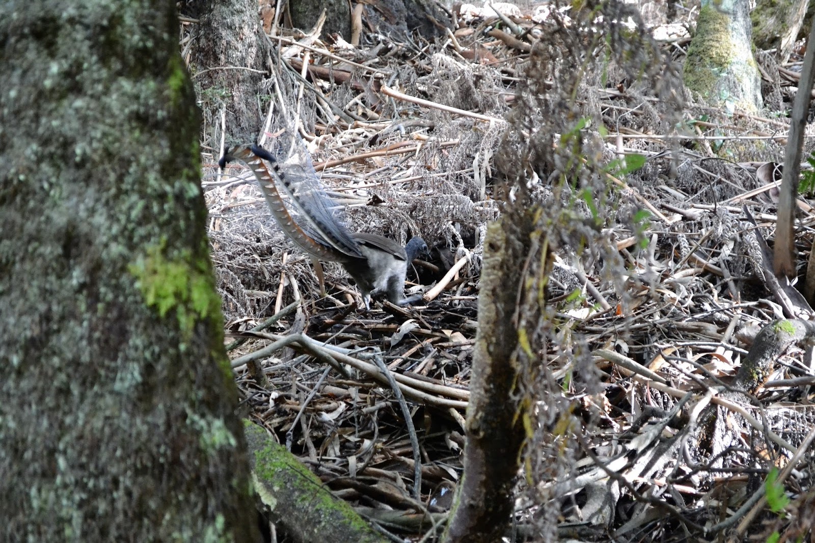
Once back on Steege Road the walking was easy again as I slowly gained height on my way up to the Tree Fern Walk. The closed Steege Road actually makes for pretty good walking with views through the trees of the surrounding hills, pleasingly now lit up by the morning sun. On reaching Tree Fern Walk my route started a slippery descent, now while my notes suggested that this section may be a bit hard to follow in reality it was like a freeway compared to Parker Link Track. It was along here that I had my most notable wildlife encounter for the day too, dropping steeply into a damp ferny gully I stopped to try and take a photo of a spiders web lit up in the early morning sun (failing miserably by the way) when I glanced to my left and noticed a lyrebird scratching around on the ground about five metres away. Normally lyrebirds are a bit skittish but this one didn't seem overly concerned with my presence, continuing to scratch around in the dirt looking for a feed. Now while I couldn't change lenses on my camera I did manage to get a couple of reasonable shots with the lens that I had on.
 |
The closed Steege Road made for pleasant walking.
 |
I was getting a few views through the trees of the surrounding hills.
 |
Descending down Tree Fern Walking Track.
 |
My most notable wildlife encounter today.
|
|
|
|
Eventually I decided to leave the lyrebird in peace and headed off again. Crossing Link Track (which maybe Triangle Track, depending on which information you believe) I continued my now gentle descent down the Tree Fern Walk. It looks like this section of the walk was along an old fire track as the gradient was very gentle, with the forest softly lit up by the now late morning sun this was a very pleasant section of the walk. Popping out of the scrub onto Triangle Road (or maybe it was Link Road?) I was meant to do a bit of a dog leg to my left to pick up Ferres Walking Track in about 400 metres, the only thing was that directly across the road was a sign post indicating the start of Ferres Track. Consulting my map I came to the conclusion that Parks Vic must have cut a new section of track to avoid the 400 metre road bash, all good in my eyes!
 |
The lower section of Tree Fern Track made for nice walking in the soft early morning sun light.
 |
| The new section of Ferres Walking Track. |
|
Ferres Walking Track basically follows the valley of Diamond Creek back to Mortimer Picnic Ground, well more or less. After a short stretch on Silvertop Ridge Track were I walked past an ink black dam my notes said Just past the dam turn left to continue following the Ferres Walking Track along the valley of Diamond Creek. Now after reading that I was already mentally pulling off my boots and sinking into the bucket seat in the ute so imagine my surprise when the track started to go up.....and up! After around ten minutes sustained climbing, and with Diamond Creek now a distant memory a long way down in the valley the track eventually leveled out. While in reality the climb was pretty mild you have to allow me a bit of poetic license, and you have to remember I was primed for a gentle creek side ramble.....oh yeah, and I'm soft!
 |
Ferres Walking Track largely follows the valley of Diamond Creek back towards Mortimer Picnic Ground, the damper soil near the creek supporting some larger trees.
 |
 |
I'm meant to be meandering my way along the valley beside the creek.
 |
| I'm not in the valley anymore. |
|
|
|
As quickly as Ferres Walking Track climbed it descended and I was soon back on the bank of Diamond Creek. With the wetter environment of the creek supporting some fairly big trees I spent my last few minutes on the walk trying to do justice to them. My notes suggested that Ferres Walking Track would come out on Link Road but a few hundred metres before reaching Mortimer Picnic Ground the track forked, taking the un-signed left fork nearest the creek soon had me back at the picnic area, the car park now full of cars.
 |
Check out this little bloke.
 |
 |
| Can you see him now? |
|
|
The Dirt.
I walked 11.4 kilometres today and climbed 278 metres on this medium grade stroll. This is walk # 38 in the house of Chapman's
Day Walks Melbourne. Now as I've already waffled on about things are a little different on the ground than in the notes, I'll try emailing the elusive Mr Chapman to let him know what the situation is but I've never had much luck with that, I think he's got me flagged as a stalker. So, assuming that I can't get in contact with Mr Chapman so he can update his
Walk Update Page then here's the dirt. First of all the track is easy to find at Mortimer Picnic Ground - look for the bridge leading across the creek to the south west. Secondly you probably want to give the Parker Link Track a miss and just climb up the closed Steege Road, you can follow the general route of Parker Link Track but it's an off track walk where you'll be relying on your compass or GPS. Thirdly from the 7.5 kilometre mark in the notes Ferres Walking Track now climbs away from Diamond Creek, more or less parallel with Silvertop Ridge Track, before eventually descending back down to the valley. Lastly when you get back near Mortimer Picnic Ground on Ferres Walking Track stay left (south) at the un-marked junction and follow Diamond Creek the last few metres back to the picnic ground.
Relevant Posts.
 |
| Mortimer Picnic Ground was a little busier now. |


No comments:
Post a Comment