 |
Lake Elizabeth
|
After casting around for a walk this week I eventually decided that the Otway Ranges would be the go. I don't mind a bit of variety in my walking and with six weeks in the Australian Alps coming up and the weather still a little to cold for the beach I figured that a forest walk would do the job. The other reason that I decided on this walk was that for a large sections of the walk I'd be walking sections of the Forest mountain bike trail network, my thinking went along the lines of, with the weather being on the damp side it might restrict the number of mountain bikers that I'd be sharing the trail with. Passing through the almost deserted town of Forest early this morning it appeared that my cunning plan might actually pay off. After parking at the West Barwon Dam Car Park and taking a couple of before photos I reset the GPS and wandered off on today's stroll.
 |
| The weather looked less than promising this morning. |
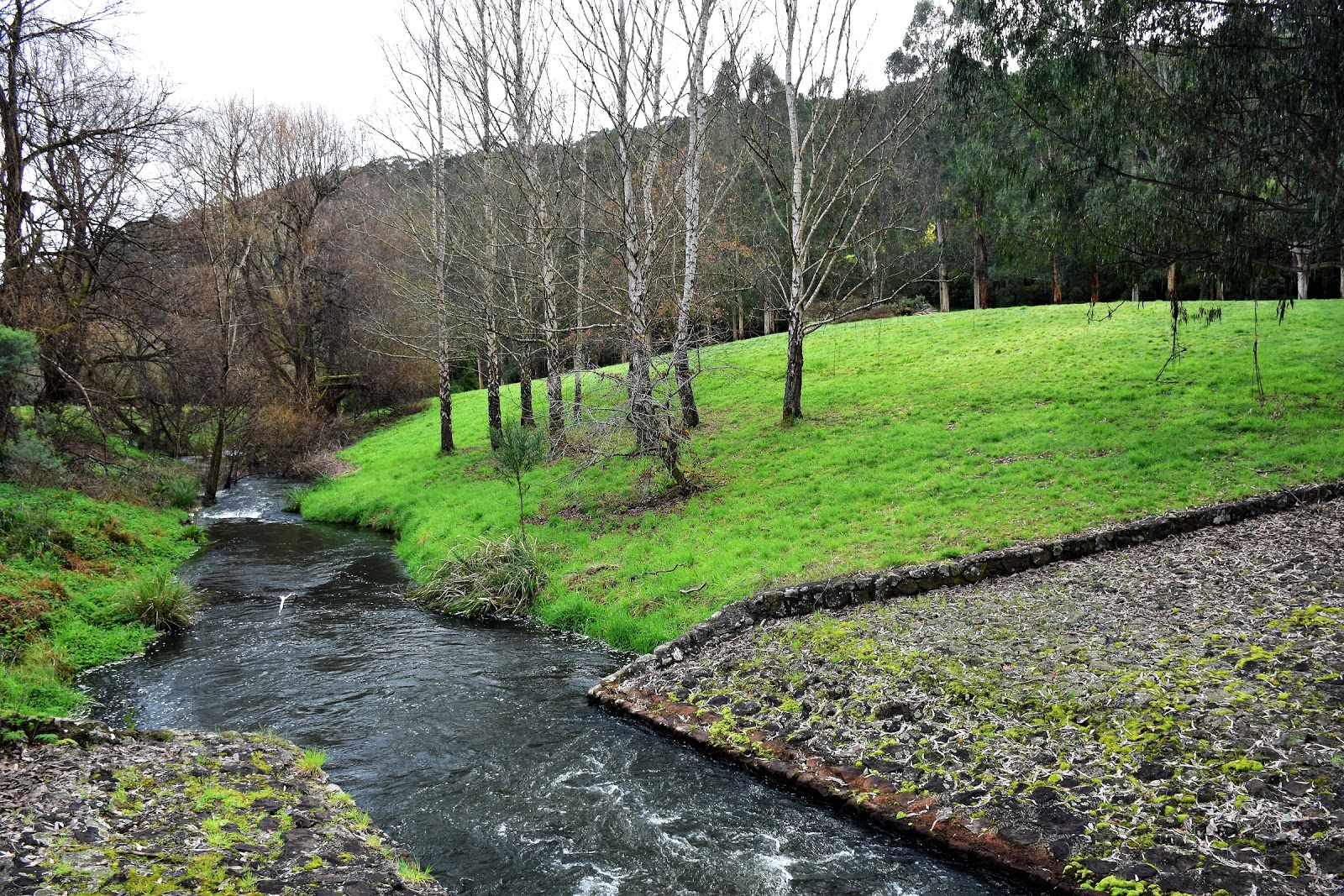
The area around the West Barwon Dam spillway is more your manicured European style park than scrappy Australian native bush, with plenty of lawn and good facilities this would be a great spot for a picnic if that's your thing. Forgoing a feed this morning I instead headed down to check out the spillway for the dam, now I'm not actually sure that technically this was the spillway, I've got an idea that it might be called a penstock, the spillway was a little further away and dry as a bone. The penstock was pumping though and it made for an interesting sight as the white water gushed into the Barwon River West Branch. Safely managing a photo without getting the camera wet I set off again, crossing the river on an old stone bridge my walk climbed into more of my natural environment, the Australian bush. After climbing a fire track for a couple metres I turned onto the signposted route 2, a shared use mountain bike track.
 |
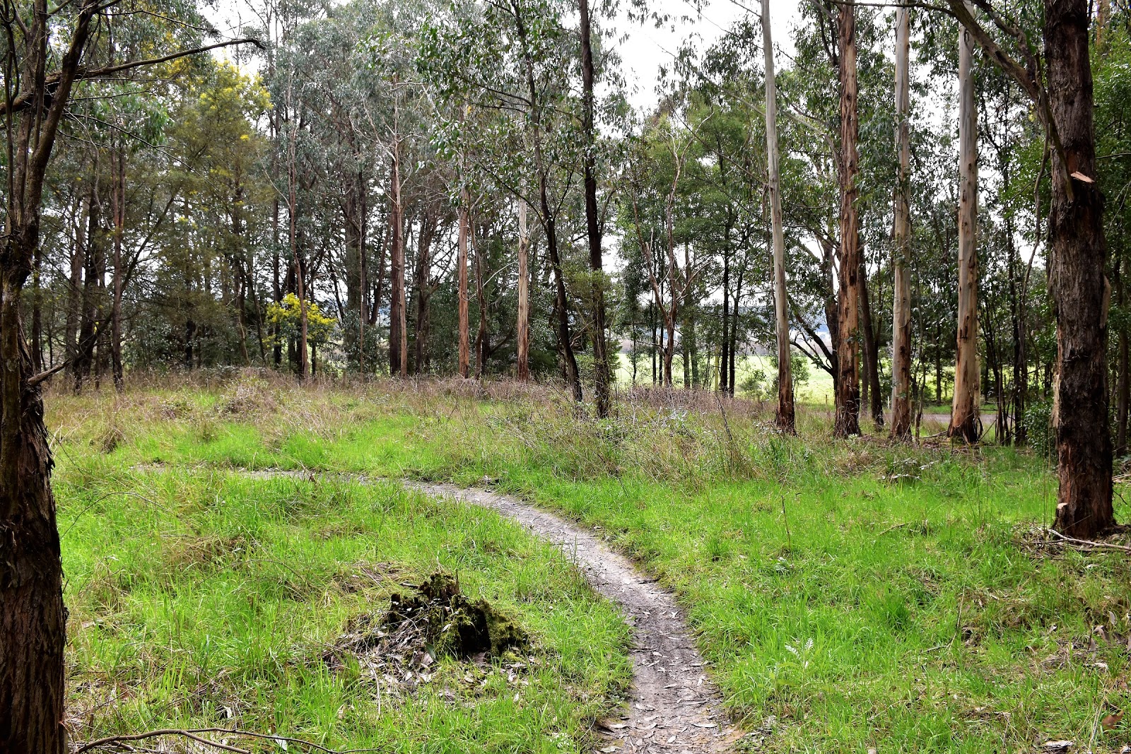
Pick up this grassy track to start the walk.
 |
West Barwon Dam penstock.
 |
Barwon River West Branch.
|
|
|
The good news for me was that from now on for the most part I'd be following this type of single track, either mountain bikes tracks or walking tracks. After an initial fairly easy switchback climb I started south along a ridge top, with Kaanglang Road parallel on one side and the water of West Barwon dam in the valley through the trees on the other, I had a feeling that there would be no navigational challenges on this stretch. The eucalyptus forest along this gently contouring track was enlivened by sections of bright yellow wattles in full bloom, as well as sections covered in moss and fungi. I've never actually mountain biked up at Forest but I've heard a lot of good things about the place and ambling along Track 2 today I couldn't help but smile to myself and think how much fun this would be on my bike. That's not all good news though because what makes for great mountain biking doesn't necessarily make for sublime walking and to be honest this three and a half kilometre Track 2 section was slightly boring on foot I thought.
 |
Track 2 passed through native scrub.
 |
The shared use mountain bike track makes for very easy walking.
 |
 |
The water of West Barwon Dam was visible through the trees in spots.
 |
Track 2 mostly heads through drier eucalyptus bush but it does enter some damper areas as it passes through some of the gullies.
 |
 |
| I seem to have taken a lot of photos on Track 2 considering that I bagged this section a bit. |
|
|
|
|
|
|
Crossing Kaanglang Road the walking improved as I dropped down towards the Lake Elizabeth car park, the descent featuring a few damper ferny sections. It was once I had passed through the Lake Elizabeth car park that this walk really improved though, I was now walking a dedicated walking track up stream along the north bank of Barwon River East Branch. This section of the walk alternated between being at almost river level and at other times being high up the steep sides of the river valley. Lake Elizabeth is a reasonably new lake, only coming into existence after a landslide in 1952 dammed the valley of the Barwon River East Branch. No prizes for guessing that the lake is named after Queen Elizabeth, this all happened in the Menzie's era, another conservative Australian Prime minister who seemed to enjoy genuflecting at the royal families feet.
 |
Things improved after I crossed Kaanglang Road and started to drop down to the Lake Elizabeth car park.
 |
I was now on a dedicated walking track.
 |
There are some nice mountain ash along here.
 |
Crossing Barwon River East Branch on the way to the lake.
 |
As the track climbed a little higher up the side of the valley I got some glimpses of the surrounding hills.
|
|
|
|
|
Lake Elizabeth is home to a population of platypus but I've never been lucky enough to spot one on my visits and unfortunately today didn't break that trend. The lookout at the western end of the lake made for a nice spot to take in the view under the weak sun today, while there were no platypus out enjoying the early spring sun there was was a good variety of water birds enjoying the still water. After relaxing awhile taking in the view and satisfying myself that the Canadian canoes were actually locked up tight and there was no possibility of me borrowing one for a scenic paddle, I decided to head off on my circumnavigation of the small lake.
 |
The view of Lake Elizabeth from the lookout, unfortunately I still haven't seen any of the resident platypus.
 |
There was a profusion of Cootamundra wattles in bloom today.
|
|
Like the lake itself this track is a fairly recent thing, having been largely constructed in the mid 1990's by Parks Vic and the Geelong Bushwalking Club. Whoever was responsible for this section of todays walk should be commended, heading anti clockwise the route climbs a little as it makes it's way through a few ferny gullies before dropping down for a side trip to the beach. Calling the small section of gravel at Lake Elizabeth a beach maybe stretching things a little, I can't see myself laying out the towel to catch a few rays, but what the beach does provide for is an opportunity to get a few water level photos. Lake Elizabeth is known (well relatively known) for the protruding stumps of drowned mountain ash trees but today there was another curiosity, with the Cootamundra wattles in full bloom around the area the bright yellow pollen was coating the lake in spots, with the gentle currents in the water creating all sorts of interesting patterns on the surface.
 |
Heading along the good track around the south side of the lake, the track sometimes climbs fairly high above the water.
 |
The yellow pattern in the still water is the pollen from the wattles.
 |
 |
The weather was still holding pretty good at this stage of the walk.
 |
The Lake Elizabeth Beach.
|
|
|
|
|
Resuming my lake side circuit I crossed a fairly long section of duck boarding over the swampy eastern end of the lake before climbing up to start my walk back above the northern shore. The walk back along the north shore contrasts quite a bit with the rest of the circumnavigation. The track along here is a lot narrower and the hillside a lot steeper with the track being benched into the steep slope. The vegetation on this side of the lake was also of the damper variety with a lot of ferns, fungi and moss giving it a bit of an enchanted forest feel, although maybe that's just the fertile Feral imagination at work! Once my lake side ramble was completed I rejoined my outward route for a bit, first retracing my route back to the Lake Elizabeth car park before climbing back up to an intersection of tracks just before Kaanglang Road.
 |
After checking out the beach I resumed my circumnavigation of the lake.
 |
Rounding the eastern end of Lake Elizabeth the track crosses a long section of duck boarding.
 |
 |
The track along the northern shore is along some pretty steep slopes.
 |
 |
| Heading back down alongside Barwon River East Branch. |
|
|
|
|
|
Reaching the track junction near Kaanglang Road I started a long walk down Track 3. As the bland name suggests Track 3 is another shared use mountain bike track, although it looks like a moderate grade mountain bike track (Track 2 was definitely an easy grade track) so it weaved and dipped in and out of the scrub a bit more which made it a little more like a traditional bushwalking track. After crossing the ever present Kaanglang Road again I rejoined Track 2 for a short section before once again heading off on a new section of Track 3 that headed through an area that looked like it might have been a gold sluicing area. This little detour wasn't on my map or in my notes so I'm not 100% sure about this little detour. After another short stretch on Track 2 I again headed off on Track 3 as it looped north, this section could really be cut off the walk as it felt very contrived on foot (it would be awesome on a mountain bike though), it almost felt that I was walking this bit just to get the stats for the walk up a little. Eventually the track curved west a descended to meet the grassy banks of the Barwon River West Branch, all that was left to do now was to wander back up stream to the dam, about a kilometre away. Once again this river side ramble is more of your manicured parkland type of walk with its lawns and deciduous introduced trees. Climbing up the the ute after arriving back at the dam my walk was over. This was a bit of a strange walk really, I think you could quite easily cut out some of the shared mountain bike trails and the walk would still be good, in fact the undoubted highlight of the walk in my eyes is the Lake Elizabeth section of the stroll and that is only just over 4 kilometres long.
 |
Track 3 is another shared use mountain bike trail and while the bermed corners would be awesome on my mountain bike they were a little under utilised today with my walking boots on.
 |
Approaching Kaanglang Road on Track 3.
 |
This section of Track 3 isn't in my notes or on my map so I'm assuming that it's fairly new, it appears to drop down through a sluicing gully.
 |
To be honest bits of Track 3 seemed a little contrived, almost as if they'd been added to the walk to get the distance up a bit. This was about as far north as I got.
 |
| Dropping down to meet the Barwon River West Branch again. |
|
|
|
|
The Dirt.
According to m GPS I walked around 18.9 kilometres today, this is a fair bit more than my notes suggested but that seems pretty normal for me, I'm not sure why that is though. I ambled through those 18.9 kilometres at an average speed of 3.9 kph and climbed 556 metres so I'd rate this as a medium grade walk. I used the notes out of the House of Chapman's Walking the Otways book, only really deviating for any length on what I presume is a new sections of Track 3. Navigation wise this walk is very well sign posted and marked so there are no problems there. The tracks themselves vary from fire tracks all the way down to bushwalking tracks around Lake Elizabeth, the long sections of shared use mountain bike tracks can get a bit monotonous in my opinion.
Relevant Posts.
 |
| I finished the walk by ambling up stream along the grassy flats. |
 |
| The old stone bridge and deciduous trees gave this a bit of a European feel. |
 |
| The last climb back up to West Barwon Dam car park and the ute. |


No comments:
Post a Comment