|
| Looking across the infant Murray River to New South Wales from tonight's camp. |
Tucked in to my little grassy flat on Stony Creek I had a good nights sleep last night. This was my first night for awhile that I wasn’t camping near brumbie pads, so subconsciously at least, I wasn’t as concerned with getting trampled in my sleep, a sub optimal outcome if there ever was one! I was up fairly early this morning too as I had a couple of things to look forward to, today I’d be picking up another food drop and then tonight, all going well, I’d reach the New South Wales border, a definite milestone on my AAWT stroll.
 |
| I had a short steep scramble up to re-join he AAWT first up this morning. |
After a relaxed brekky I shouldered my pack and scrambled up the steep western side of the creek to pick up the AAWT again. Mr Chapman’s notes said to
follow brumbie tracks staying within sight of the creek so once again I was braced for a bit of a tough walk, once again though conditions had obviously changed fair bit since Mr Chapman had passed through. The pad along Stony Creek was fairly obvious for the most part, the only sections that had me really concentrating was where the AAWT headed down to cross some of the creek flats, it was always a little harder to pick up the ongoing track when leaving these flats. So with the walking being a lot more enjoyable than I’d feared I was in a slightly euphoric mood as I ambled upstream, my revery was broken though as I glanced to my right and noticed a sun baking Copperhead Snake on the high side of the track at about waist height, yep that got my attention! It was more that I didn’t see the snake until the last minute that was the problem, the snake itself didn’t move a muscle as I leapt off the downhill side of the track to escape.
 |
| Old mate Mr Copperhead didn't seemed overly fussed about the Feral walker thankfully. |
With my mind now super focussed every second stick littering the floor appeared like one of my cold blooded serpent mates ready to strike, it certainly kept the heart rate up a bit. After a short stretch along an old firetrack I dropped down to the old marble quarry that I’m guessing the road serviced at some stage. Stony Creek was now frequently going subterranean as I made my way up the narrowing valley, coming to the end of my creek side sidle I stopped for a minute to take a shot of the spur that I’d be climbing up to Cowombat Flat Track. It was while pointing the camera in the general direction that I figured that the AAWT would take me, that I was startled by a ladies voice yelling out. The lady behind the voice was Anne, I’d known that Anne was walking the AAWT from the north to the south at around the same time as me and she had said that she thought that we’d cross paths near the border, but it was still a very pleasant surprise to actually see her. As was usual for me it quickly became apparent talking to Anne that she was doing it a lot easier than me on the walk, Anne was powering down Stony Creek this morning to meet up with her partner and head into Omeo for a night of R+R so I didn’t hold her up too long. As I was leaving Anne she mentioned that my holiday was about to begin, I’d heard that the NSW section of the AAWT was easier but it was nice to hear it from someone who had just walked it.
 |
The pad along Stony Creek generally contours along the western side of the valley.
 |
This limestone bluff is a bit of a feature on the walk up Stony Creek.
 |
 |
| I'm about to start climbing up to Cowombat Flat Track. |
|
|
|
So with Anne’s words ringing in my head I almost bounded up the spur to meet Cowombat Flat Track…almost;) Reaching the top of the spur that had been my route up from Stony Creek I emerged from the scrub onto Cowombat Flat Track and was now in familiar territory again, not only had I been in here recently with Sam doing a food drop but this was also a spot that I had visited on a three day walk up to the Cobberas a year or so ago. It was the food drop that I was interested in today though, walking around ten metres down Cowombat Flat Track I headed bush again to the spot where my box of goodies was hidden, thankfully finding it undisturbed by the local population of marauding horses. Now I haven’t mentioned the weather today so far, over the course of the morning the clouds had been building up and now as I unpacked my next few days worth of supplies it looked like precipitation was fairly imminent. So with the weather at the front of my mind I didn’t linger too long here, sorting out my food and maps I soon had everything I needed to get to Thredbo in my pack and after stashing the bin I was off again.
 |
Once again the AAWT was easy to follow and well defined as it climbed up to Cowombat Flat Track.
 |
Emerging from the scrub onto Cowombat Flat Track, my food drop was only a couple of minutes away....happy days!
 |
| If you don't include Mt Hotham this was my fourth food drop on the AAWT. |
|
|
For the rest of the day the AAWT would follow Cowombat Flat Track so I wasn’t expecting any real navigational issues this afternoon. With extra food in it, I swung my now somewhat heavier pack onto my shoulders and headed off again. For the last couple of days I’d been feeling a bit crook, I suspect due to drinking a bit of dodgy water. It’s almost impossible to get water along this section of the AAAWT that hasn’t been spoiled by the feral brumbies running around so everything needs to be treated, a situation that I was a bit slow to pick up on! So anyway while the walking along Cowombat Flat Track was pretty easy I didn’t have a lot of energy to burn as I trudged along towards the Cowombat Flat Carpark.
 |
Easy walking along Cowombat Flat Track.
 |
| Heading into the Cobberas Wilderness Zone at the Cowombat Flat Carpark. |
|
After another little rest at the carpark I passed through the locked gate and dropped down to cross Bulley Creek and pass through a second gate. The weather that had been threatening for a few hours now arrived as I shuffled my way towards Cowombat Flat, I was now engaged in a game of jacket on, jacket off as I tried to judge whether I was better off getting wringing wet with sweat or rain as the showers passed through. Cowombat Flat Track proved to be a fairy straightforward and uneventful walk overall, I got a few fleeting views through the trees over the deep valley that the infant Murray River flows through but part from that it was more or less a head down, chew it up and spit out the kilometres.
 |
I got a few glimpses of the Cobberas through the trees along Cowombat Flat Track, this is Moscow Peak poking it's head out in the distance.
 |
| My walk along Cowombat Flat Track seemed to take an eternity this afternoon. |
|
When I was walking it, my progress along Cowombat Track seemed incredibly slow, but arriving at the large green grassy expanse of Cowombat Flat just after 3pm, perhaps it wasn’t as bad as I’d thought. Meandering down across the open grassy plain I pitched the tent around 10 metres from the infant Murray River. With camp set up I couldn’t resist wandering over to the river to jump over and set foot in New South Wales for the first time on this walk, I’ve swum back and forth across the Murray River quite a few times 100’s of kilometres down stream where the river is 50 metres or so wide so being able to step across the same river with dry feet was a bit of a novelty for me today.
 |
There was a bit of weather around this afternoon.
 |
I got a few glimpses to the west.
 |
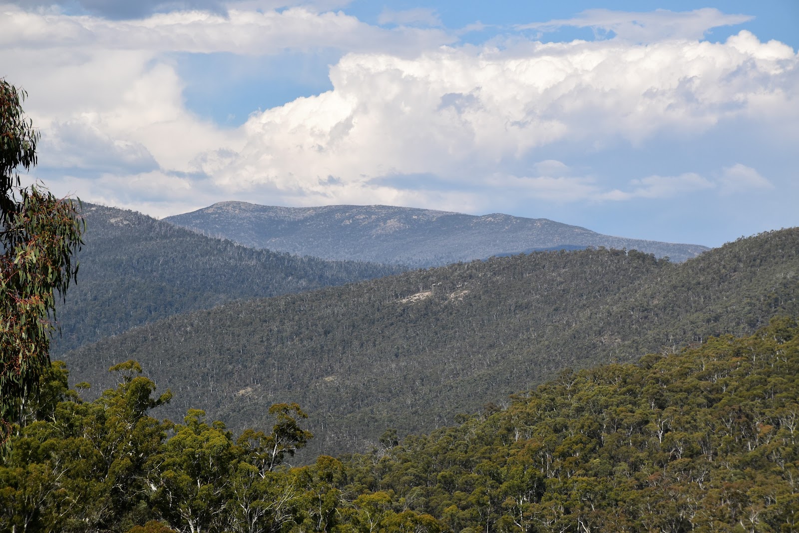
| Dropping down to Cowombat Flat Track I got a look at The Pilot, now a lot closer. |
|
|
Returning to camp I grabbed my chocolate that I’d picked up in today’s food drop and headed over to share it with Hilly and Libby, who were camped in a small copse of trees 100 metres away. My afternoon at Cowombat Flat passed fairly quickly as I chatted with the ladies and relaxed. Returning to my tent later that evening I made some notes about the day as I listened to the horses galloping up and down the valley around me, saying a silent prayer that they taken notice of my bright orange tent pitched on their runway.
 |
| Cowombat Flat |
The Dirt.
I walked 21 kilometres today and climbed 780 metres on another hard day on the AAWT. Over the 26 days of my AAWT adventure so far I’ve walked 442 kilometres and climbed 20,965 metres. After leaving Stony Creek I picked up water at Bulley Creek, there was also water at Copperhead Creek, Mountain Trout Creek and a couple of other spots along Cowombat Flat Track (I was back up here at the end of February and these creeks were all either dry or just trickling). The infant Murray River at Cowombat Flat provided water for camp. Navigation wise today was more straight forward than I’d imagined reading my notes, the main issue was the first 4 kilometres or so up Stony Creek until the AAWT started to climb up to Cowombat Flat Track, the pad on the steep slopes above the creek was generally pretty well defined and easy to follow but when the pad descended to cross the creek flats things could get a bit vague with the multitude of brumbie pads around. Camping wise there are quite a few spots along Stony Creek and then along Cowombat Flat Track, the best spot though is easily the wide open expanses of Cowombat Flat. I didn’t get a mobile signal today. I used John Chapman’s notes and maps as well as Rooftop’s Bright - Dartmouth Adventure Map for an overview.
Relevant Posts.
AAWT, First day, October 2017.
AAWT, Previous day, November 2017.
Cobberas Walk, Day 1, October 2017.
 |
| Cowombat Flat is a very pleasant spot to spend a night or two. |
 |
| Tonight's camp was a good one, that's the Murray River in flowing down that scrubby gully behind my tent. |