F#*k!... Yeah, that was the first word that came into my mind as I suddenly found myself trying to stem the now constant stream of blood dripping from my head, cursing myself for being so bloody clumsy. The day hadn't started off so badly though, with another balmy mid twenty degree day forecast I thought that I'd make the most of the promised blue skies and head back up to the Cathedral Range State Park and re walk the Northern Circuit. It had been quite a few years since I've walked this end of the range, in-fact I haven't been here since before Black Saturday bush fires decimated the place in 2009, so I was curious to see how the bush was going. Now for anyone who reads this waffle here's the most amazing occurrence of the day, I was actually on my way to the walk by 6am, the only nod to my normal Saturday coffee and newspaper routine was a quick stop at the golden arches for a takeaway coffee. After a pleasant drive over the Black Spur I was pulling on my boots and setting off from the Neds Gully car park before 8:30am.
 |
| Crossing Little River at the start of my days walking. |
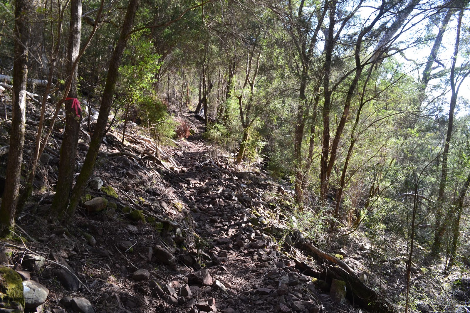
I decided to start my days activities from Neds Gully and head straight up onto the range from there, leaving an easy ramble back along Little River for the end of the walk (yeah, remember that last line). The initial loose plan had me ascending the range via the Neds Gully Track, this is a nice easy way way up onto the crest of the range. After passing by the Cathedral Range Humpy the meandering Neds Gully Track arrives at a 4 way intersection of tracks, I turned hard left and climbed to my first peak of the day, Neds Peak. Neds Peak is a bit of an outlier not actually being on the crest of the Cathedral Range, so the views while extensive are not quite as extensive as for the peaks on the range crest. Still the top Of Neds Peak was a good spot to stop for awhile, shed my thermals and have a drink, being only 9:30am the sometimes busy range was still very quiet.
 |
8:30am, it was an early start for me!
 |
The Cathedral Range Humpy.
 |
| First peak of the day, Neds Peak. |
|
|
Leaving the top of Neds Peak I headed back to the well signposted track junction taking the route over to Little Cathedral. The track over to Little Cathedral is a little vague to start off with due to some tree fall, but keep going and all becomes clear in around 100 metres. My walking notes suggested that I would be following a track across an unspectacular hillside, so I wasn't expecting much on this leg of my walk, but actually I really enjoyed this track as it contoured around to the saddle on the main ridge near Little Cathedral. The views as I crossed the open rock slabs and scree slopes included misty valleys as well as the rocky ramparts on Ten Fathom Ridge across the gully, all giving me reason to pause to take it in.
 |
The start of Little Cathedral Track is a little vague, cross these fallen trees and all will soon become clear.
 |
Once I hit the scree slope the route was obvious .
 |
| Ten Fathom Ridge. |
|
|
Once I got to the saddle on the main ridge below Little Cathedral the views would remain almost constant for the next few hours. First up though after meeting the main track that traverses the ridge crest I headed north a little more to the extreme northern peak on the range Little Cathedral, even though the peak is slightly lower than some of the others that I would climb today its isolated position at the end of the Cathedral Range means that the views from the rocky summit were still very good. With no shortage of rocks to perch on it was also a great place to stop for a bit of a break while checking out the view of Taggerty in the valley below.
 |
Little Cathedral Peak.
 |
| The view from Little Cathedral was anything but little, second peak for the day. |
|
Dropping back down the rocky track from Little Cathedral I headed back to the track junction in the saddle, this time though I kept to the crest and started the climb up to Cathedral North instead of heading back towards Neds Gully. The walking along the ridge top of the Cathedral Range is fairly rough, the track in spots right on the edge of the precipitous western cliffs, not a place to make a mistake. The initial climb up to Cathedral North keeps slightly east of the cliff line though, passing through sections of regrowth as it climbs steeply before suddenly bursting out of the scrub as I arrived at the summit. At 814 metres summit of Cathedral North once again supplies great views, the view up the range towards Little Cathedral from near the trig being particularly good, a Wedgetail Eagle soaring on the thermals icing on the cake really.
 |
The route up Cathedral North keeps just to the east of the cliffs passing through bush fire regrowth.
 |
| The view from Cathedral North trig back towards Little Cathedral, third peak of the day. |
|
Leaving Cathedral North I rock hopped my way along the tops towards Cathedral Peak, the route along here staying on or close to the crest. The view from Cathedral Peak stretches along the Archeron River Valley all the way back towards Dom Dom Saddle at the top of the Black Spur, the open farmland of the Archeron Valley contrasting with the forested mountain sides. Leaving the top of Cathedral Peak I bumped into the second group that I'd seen this morning, these girls were on the second day of their walk having camped at The Farmyard last night. The Farmyard is the only designated bushwalkers camp on the range and is a very popular spot particularly with scouts, although the girls reported that it was pretty well deserted last night. I may have mentioned this on my last post about the Cathedral Range but The Farmyard is so named because of the Lyrebirds that inhabit the area that mimic the sound of the farm animals down in the Archeron Valley.
 |
Regrowth on Cathedral Peak, peak number four.
 |
| Looking south along the range towards Sugarloaf Peak. |
|
Once the route leaves the top of the Cathedral it more or less stays on the very top of the knife edged ridge, the walking is stunning and the views extensive, today the view also included a large plume of smoke billowing from what I presume was a controlled burn in the distance. My attention was drawn along the ridge of the Cathedral Range stretching ahead of me to the south, in the distance it was crowned by the rocky spire of Sugarloaf Peak but in the fore-ground was another rocky rampart that drew my eye and that was my next objective, North Jawbone Peak. Before I could get to North Jawbone Peak though I had quite a bit of slow walking along the tops, although the rock scrambling was infinitely preferable to pushing through the scratchy scrub that blankets the approaches to the tops. Has Australia got the scratchiest scrub in the world? It doesn't seem to matter which state I walk in they all seem to have more than their fair share of inhospitable flora.
 |
A controlled burn going off in the distance.
 |
My next objective is North Jawbone Peak, on the left in the middle distance.
 |
The Farmyard Track along the ridge sometimes keeps right on top of the ridge making for slow but extremely scenic walking.
 |
| On the odd occasion that the route drops off the tops I sometimes found myself pushing through small bands of this stuff. |
|
|
|
As the ridge top track nears The Farmyard (the track is called The Farmyard Track incidentally) I dropped off the crest of the ridge onto Jawbone Creek Track, dropping easily to a grassy saddle below North Jawbone Peak. From the grassy saddle I made the short steep climb to my last peak of todays ramble, North Jawbone. Arriving on the broad timbered summit I was initially a little underwhelmed (I'd never climbed this peak before), before noticing an out crop of rock to the south, sure enough this rocky perch was the best spot to take in the uninterrupted views along the ridge towards Sugarloaf Peak, now with South Jawbone Peak in the foreground and ridge after ridge of blue mountains receding into the distance, unfortunately all crowned with the stubble like dead Mountain Ash trees killed in the 2009 fires.
 |
 |
| The view south from North Jawbone Peak, peak number five for the day. That's South Jawbone Peak in the foreground and the pinnacle like Sugarloaf Peak in the back ground. |
|
After a late lunch on North Jawbone Peak I started my descent off the range, the track starts off fairly gently until it intersects with the track coming down from The Farmyard, from here on it plunges down into Maclennans Gully via a seemingly never ending series of dry stone steps. The steps make the descent quicker and easier than the old track that was very eroded and steep, but by the time I reached the bridge over Maclennens Gully my feet were happy to be down. After a short steep climb out of the gully I reached the Jawbone Carpark before picking up St Bernards Track and following that down to Cooks Mill Camp, the gentle St Bernards Track making a pleasant change for my feet after the steep descent down Jawbone Creek Track.
 |
The dry stone steps as I descended Jawbone Creek Track, a lot of effort has gone into this section of track.
 |
Reaching Maclennans Gully I was faced with this little heart breaker.
 |
| North Jawbone Peak from St Bernards Track. |
|
|
Cooks Mill Camp marked the start of my easy ramble back down Little River (remember that second paragraph) to the ute at Neds Gully Carpark and I was feeling pretty content with life as I set off along the river. Around 100 metres after leaving Cooks Mill however my pretty riverside amble appeared to come to an end as the track spat me out into a large clear felled logging coupe, I'd gone from the sublime to the ridiculous. After half a kilometre or so through the waste land that is a logging coupe I started to wonder if I'd missed the track as there was a narrow band of native bush lining the banks of Little River and my notes along here suggested that the track hug's the rivers west bank. Anyway to cut a long story short, in the best feral tradition, I decided to head across country to the west bank of the river to see if I would intersect with my hoped for walking track, yeah what could possibly go wrong? Well, it didn't start off to good as I pushed my way through the dense riverside vegetation, the damp vegetation consisted of another of Australia's anti social plants Sword Grass, to keep my legs from getting to cut up by the grass I tried using fallen trees to keep me out of the more anti social flora. The balancing on trees method actually worked pretty good and within a few minutes I was on the west bank of the river, alas no walking track. Now resigned to the fact that the logging coupe was the walking track I back tracked using the log method again to protect my legs. With about 10 metres to go before I reached open country everything came to a screaming halt, one second I was on a greasy log, next second I'd slipped, head butted a stick that was protruding from the ground like a stake waiting for a vampire, and now I had blood streaming out of a cut just below my right eye, like I said, F#*k!... With the warm blood now trickling down my face onto my shirt I ripped off the first thing that I could, my walking glove, and pressed it to my face where I figured the cut was. A few minutes and one blood soaked glove later I'd stemmed the bleeding enough to concentrate on getting out of the scrub and back onto the route. On of the issues with solo walking is that you can't see your own head (although in my case that's normally a positive) so I had to resort to taking a selfie so that I could check out the photo to get an idea how bad the damage was, luckily it appeared that the cut wasn't too bad but it was already swelling and I could feel a decent headache coming on.
 |
Heading back along Little River through a clear felled logging coupe.
 |
So I decided to head off piste to see if I'd missed the track near the river.
 |
Back on the logging track, if only I'd seen this marker a little earlier!
 |
| A cut and bloodied feral walker. |
|
|
|
Feeling a bit pissed off with myself I once again resumed my journey through the logging coupe, almost immediately coming to a track marker nailed to a stump in the wasteland, hmm that would have a saved me a few issues....oh well such is life. Apart from the visual side of things in the logging coupe I was now also keen to return to the banks of Little River so I could clean myself up a bit, judging by the blood on my shirt and on my glove I figured that there must be some on my face. After another half a kilometre or so the Little River Track did indeed return to the bush and before long I found a short side track down to the nice river, the contrast between this peaceful spot and the clear felled wasteland was stark. My first job was to rinse the blood out of my glove before I turned my attention to my face, with the help of the camera I cleaned myself up as best I could tell. I guess I'd tell how well I'd done when I bumped into some more walkers, if they ran away screaming then obviously I'd missed a bit of blood. I didn't actually meet any walkers for awhile though, instead I gave the camera a workout trying to get a photo of a Lyrebird foraging around on the track 50 metres ahead of me but the results were fairly under whelming unfortunately. Eventually I did bump into some other walkers, a couple of blokes that I'd met earlier on top of the range, when they didn't run away screaming I figured that I must of got most of the blood off my face. Crossing over the suspension bridge at Neds Gully Camp I was back soon at the ute, throwing my smelly boots and gaiters in the back I grabbed my first aid kit and was able to do a bit of maintenance on my face using the mirror in the ute, hmm I was going to look pretty second hand for a couple of days. Man vs Wild - Man 0 ....Wild 1.
 |
Eventually I did arrive onto the banks of Little River, a great spot to wash all the blood away!
 |
| The best I could do with the Lyrebird, the only problem with the DSLR is that I've never got the right lens on at the right time. |
|
The Dirt.
Ok what's the dirt on this walk, well first up I'd rate it as a hard walk, I walked 18.1 kilometres and climbed 976 metres over the course of my 7 hour ramble. The tracks in the Cathedral Range State Park are generally pretty well marked and signposted though so navigation isn't normally much of an issue. I used the old Cathedral Range 1:25,000 Vicmap, although it dates back to 1993 its enough for me, I also used Melanie Balls book
Top Walks in Victoria, the maps in Melanie's book are good enough to do the walk without worrying about the Vicmap, my route sometimes differed from Melanie's in that I started at a different spot and climbed a couple of extra peaks in Neds Peak and North Jawbone Creek but her maps have all that covered. As is usual for Victoria, Parks Vic also have a lot of free information on line about the park that is worth checking out. The clear felled logging coupe along Little River is an old pine forest so lets hope that now its been chopped down its revegetated with natives its always been a bit shitty having a pine plantation in the middle of such a nice little park. Finally if you want to read some more of my waffle then here's a link to a post about the
Southern Circuit that includes Sugarloaf Peak.
 |
| The Swordgrass did a fair bit of damage to my legs. |
 |
| But not as much as the stake did to my face, actually I was pretty lucky really it wasn't far from my eye. By the way in all my years wandering around the bush this is probably my second worst injury so I can't really complain. My worst injury was near Frenchmans Cap in Tasmania where I went arse over on a scree slope comprising sharp quartzite rocks, I sliced my shin to the bone there and had two days walk to get out. |


No comments:
Post a Comment