 |
| I got a fairly early start today on what the radio was telling me was going to be a pretty warm day. |
I enjoyed another great night on my own last night at Witzes Hut, the historic hut made for a very comfortable spot to spend the night. Sitting around reading the hut’s log book last night I noticed that my friend from back near the Victorian border, Hilly, had passed through a couple of nights ago. Reading the entry it sounded like she was still going strong and I wondered whether I’d catch her before we reached Canberra, although knowing how quickly Hilly walked I somehow doubted that I would. With another fairly long day in front of me today I was packed up and on my way by around 8am again this morning, it certainly is a lot quicker breaking camp when I didn’t have a wet tent to deal with.
 |
| The easy fire track walking continued. |
Leaving Witzes Hut the AAWT continued along Nungar Creek Trail for about 300 metres before striking out across the edge of Blanket Plain on Bullock Hill Trail. Like yesterday these grassy tracks made for very pleasant walking as the AAWT continued to head north crossing wide open grassy alpine plains. After winding around a bit and passing Haines Hut Trail the AAWT started a long gentle descent down to Tantangara Creek. I’d had this crossing at the back of my mind since crossing Tantangara Creek many kilometres up stream yesterday afternoon, even with the help of a bridge I still had to hop across the tussock grass to keep my feet dry and the creek itself had looked very deep.
 |
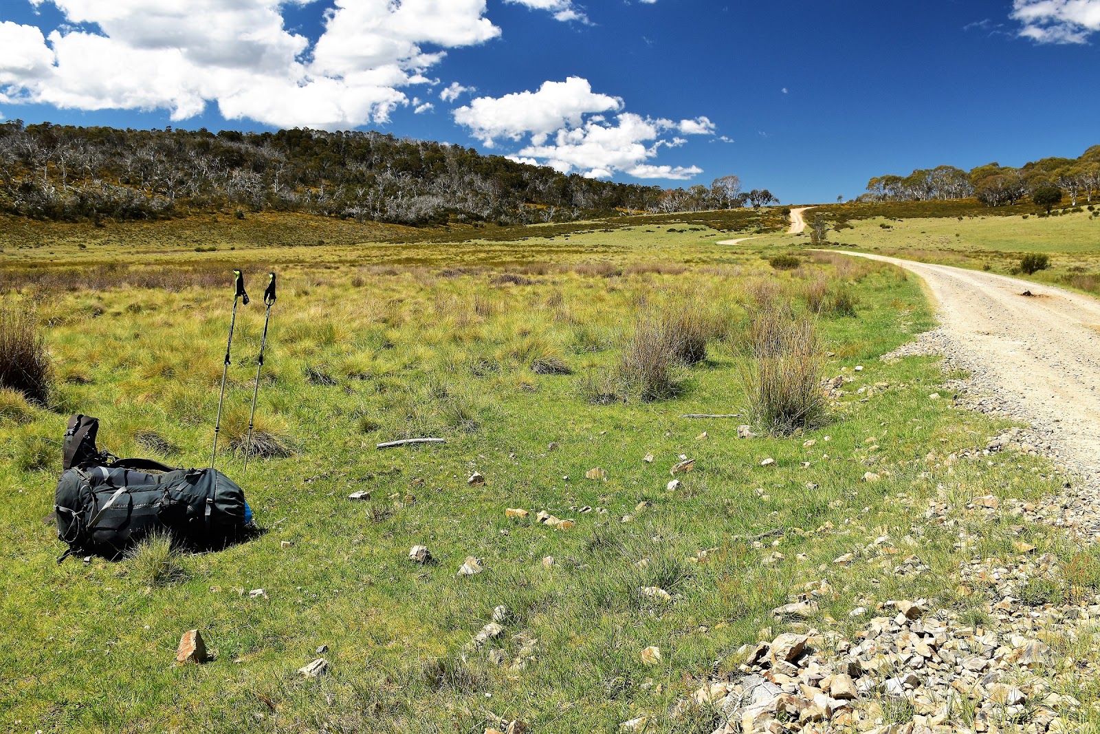
Blanket Plain
 |
Bullock Hill Trail was another of those grassy jobs.
 |
The scenery was still pretty easy on the eye.
 |
 |
| Bullock Hill Trail |
|
|
|
|
Arriving on the eastern bank of Tantangara Creek this morning I could see that while I wouldn’t be crossing with my boots on, I would still be able to get across safely, although I’d still have to be careful. Pulling off my boots, gaiters and socks I managed to stash them safely in my pack and waded in, bracing myself with my poles and edging across the deep, fast flowing currant. With the icy water lapping towards the top of my thighs once again I was pretty happy when I emerged dripping wet onto the grass on the other side. Stopping for a minute to drip dry in the sun I checked out my map and notes, with only around a kilometre until I reached the next water obstacle I decided that I may as well trudge there in my sandals.
 |
Bullock Hill Trail dropping down to Tantangara Creek.
 |
There was a bridge over Tantangara Creek at one stage.
 |
Tantangara Creek, this crossing was high thigh deep.
 |
| Good for water crossings, not so good for snakes in the tussock grass! |
|
|
|
Arriving down on the bank of the Murrumbidgee River I checked out the situation in front of me, the good news was the crossing looked do-able, the bad news was that it was going to once again be pretty deep and I had two channels to get across. With a very deep entry it was a matter of sitting on the bank and easing myself into the water until my feet touched solid ground, the water this time around waist deep was doing it’s best to deposit me down stream into Tantangara Reservoir. Thankfully the second channel was a bit shallower and I emerged dripping onto dry land safely, it was time for a bit of a break while I dried off a bit.
 |
Shuffling my way over to the Murrumbidgee River in my sandals.
 |
The start of the off piste section.
 |
The Murrumbidgee River, this one was deep!
 |
That channel was waist deep, I had to ease my way in off the tussock grass until my feet felt solid ground.
 |
| There was a few locals around taking in the sun while I dried off. |
|
|
|
|
After drying off under the warm sun I left the Murrumbidge River behind me and climbed gently up a valley, the AAWT now going off piste for the next six or so kilometres until I reached Port Phillip Trail. Now you’d think going off track for a couple of hours might make for some hard walking but in reality this six kilometres was some of the nicest walking along the NSW section of the AAWT, the open grassy almost park like country made off track walking a breeze. With a wide valley to follow that more or less funnelled me in the right direction and a derelict old telephone line on a ridge just over half way to Port Phillip Trail to confirm that I was heading the right way, meant that even the off track navigation wasn’t too tough.
 |
Alright, I'll just keep heading that way.
 |
Off track walking doesn't get much more pleasant than this really.
 |
Conditions underfoot were still a little damp after the rain a couple of days ago.
 |
| If you look closely you might see the pole line that has just come into view on the side of the hill. |
|
|
|
Arriving at the old telegraph line in the early afternoon I sat down under a shady tree to savour things a little. With the old tree as a back rest I found it very hard to get going from this comfortable spot, convincing myself more than a few times that another 15 minutes wouldn’t matter much as I snoozed the the afternoon away. With Canberra getting no closer though eventually I set off again, following the old telegraph poles a bit further before once again striking out across country towards Port Phillip Trail, aiming to meet the trail where it crossed Bally Creek in a few kilometres. Once again navigation across here was pretty easy although it paid to stay east a bit close to some low hills, as the direct route across the flat plain was a little on the boggy side.
 |
I've just wandered up that valley.
 |
 |
 |
Leaving the old telegraph line the easy off track walking continued.
|
|
|
|
Arriving at the very substantial Port Phillip Trail at Bally Creek it was time to re fill my water bottle and check the map. By now it was mid afternoon but looking at the map I only had around 5 kilometres to go to reach my intend camp at Hainsworth Hut so I wasn’t really under any time constraints and looking at the map it appeared that I’d be once again following fire trails all the way to camp. Shouldering my pack I trudged on up Port Phillip Trail, the wide gravel road not giving me much relief from the sun as I sweated my way north. With some relief I left Port Phillip Trail at the large Ghost Gum Camping Area and turned up the closed Mosquito Creek Trail. This trail is more typical of a lot of the NSW sections of the AAWT, being fairly grassy and faint, the soft surface certainly made walking a lot more pleasant than the hard gravel of Port Phillip Trail.
 |
Bally Creek
 |
I've just met Port Phillip Trail at Bally Creek.
 |
| There isn't a lot of shade along Port Phillip Trail. |
|
|
Around an hour after passing through the Ghost Gully Camping Area I arrived at the very indistinct side track out to
Hainsworth Hut, with the hut not visible on the far side of a low ridge it’s important to identify this very faint track although from memory
I think it was signposted. A short five minute shuffle later and I was dropping my pack out side the spartan looking Hainsworth Hut. This old hut dates back to 1951 and was originally built for grazing, it’s a two room job made completely of tin, there is not even any glass in the windows, just tin shutters. Needless to say it was pretty warm and stuffy inside on this warm afternoon. After opening up the windows I spent the remainder of the afternoon sitting on the front step in the shade listening to ABC local radio and relaxing a bit, only rising occasionally to take a wander around the immediate area with the camera to see what I could find of interest, dropping down to the nearby Dip Creek for a bit of a drink and a wash when I could muster the energy.
 |
Leaving Ghost Gully Camping Area I headed along the almost deserted Mosquito Creek Trail.
 |
There are still plenty of long range views to be had off Mosquito Creek Trail. I'm thinking that is Skaines Mountain.
 |
 |
| Hainsworth Hut, I spent a pleasant afternoon sitting on the step in the shade listening to ABC local radio. |
|
|
|
The Dirt.
I walked 24 kilometres today and climbed 400 metres on another hard day on the AAWT. Over the course of my 36 days walking the AAWT so far I’ve walked 651 kilometres and climbed 26,280 metres. Water and camping was all pretty plentiful when I walked through here. There is around 6 kilometres off track that needs to be navigated today, but to be truthful it’s pretty easy to find your way through with no scrub and gently rolling countryside this is about as easy as off piste navigation goes. There are a couple of water crossings today that you need to be careful of if there has been bit of rain and unlike the Eucumbene River yesterday there is no easy way around the crossing of the Murrumbidgee River today. I didn’t get a mobile signal today. I used Chapman’s notes and maps today as well as carrying Rooftop’s
Kosciuszko Northern Activities Map Kiandra - Tumut in case I needed an over view.
Relevant Posts.
AAWT, Day 1, October 2017.
AAWT, Previous day, November 2017.
 |
| Dip Creek below the hut. |
 |
| It must of been a wild old night up here for my responsible gun owner mates... |
 |
| As day faded into night the light rarely disappointed me. |
 |
Time for bed.
|


No comments:
Post a Comment